The Land That Raised Me
Personal Cartography · Advanced Architectural Representation
The Land That Raised Me explores the idea that geography is not fixed by borders, roads, or measurable distance, but gradually constructed through lived experience.
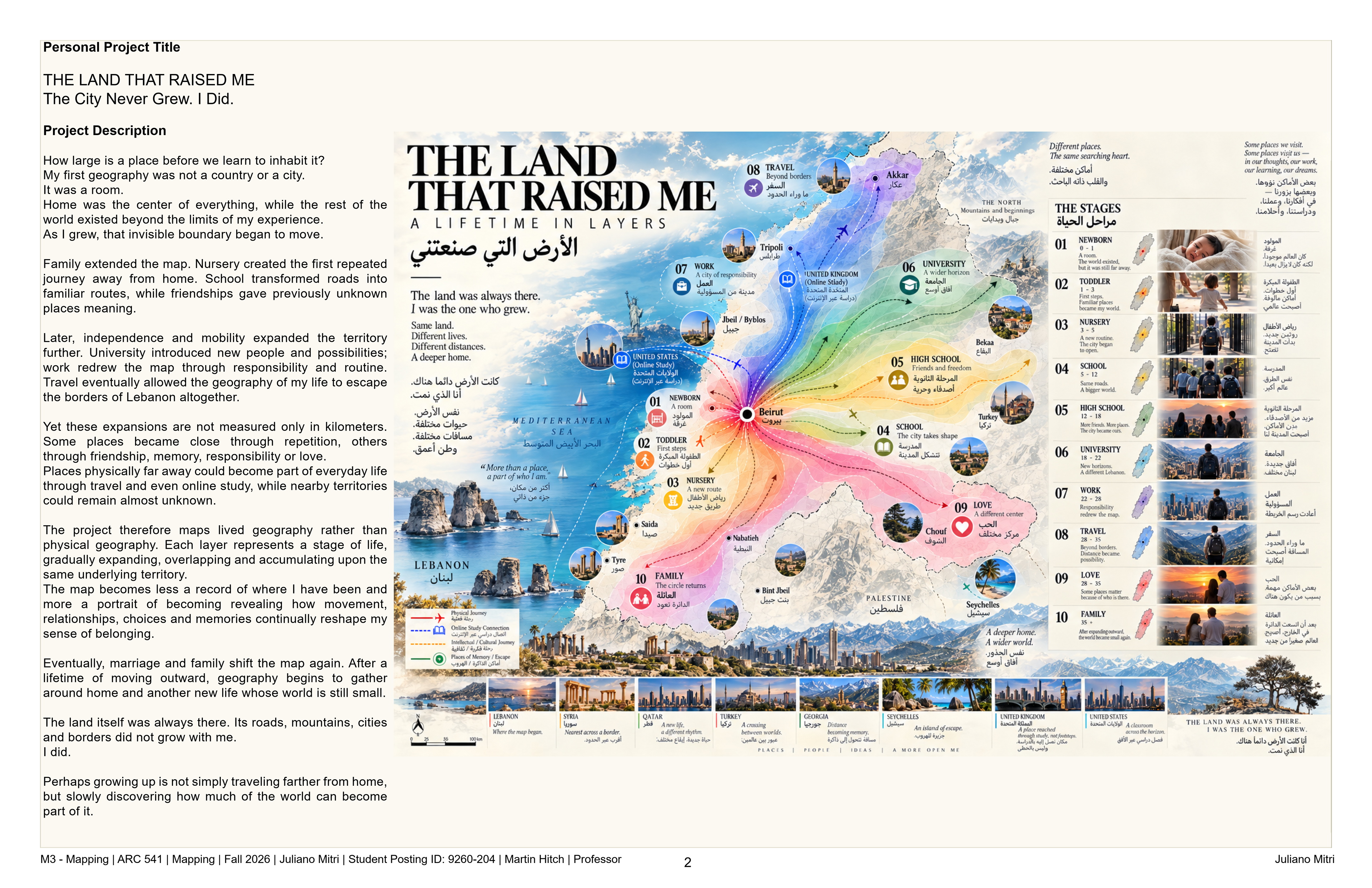
The project begins with a simple question: How large is a place before we learn to inhabit it?
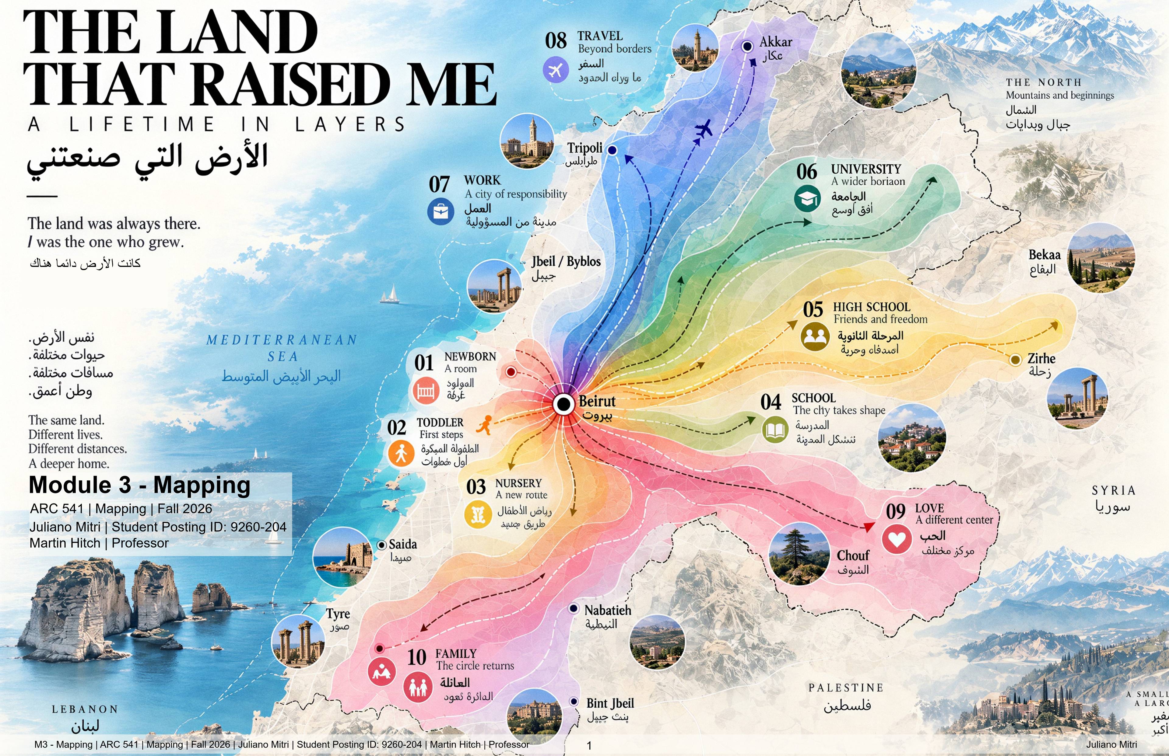
My first geography was a room. As life unfolded, that territory expanded through family, school, friendship, independence, university, work, travel, love, and eventually family again. Places entered the map not simply because I travelled farther, but because people, routines, memories, responsibilities, and relationships gave them meaning.
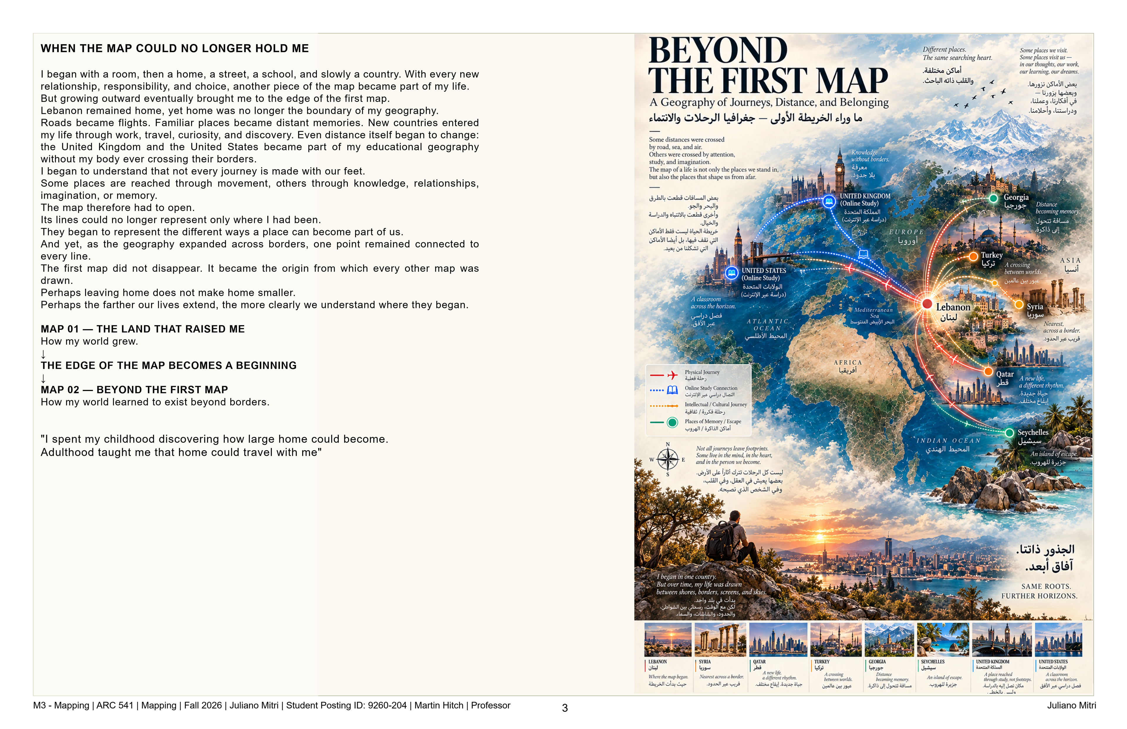
Lebanon becomes the underlying territory upon which these stages accumulate. Each layer represents a widening personal geography from the intimacy of home to a network extending beyond national borders. A second map expands this idea further, tracing physical journeys alongside places reached through education, work, memory, and digital connection.
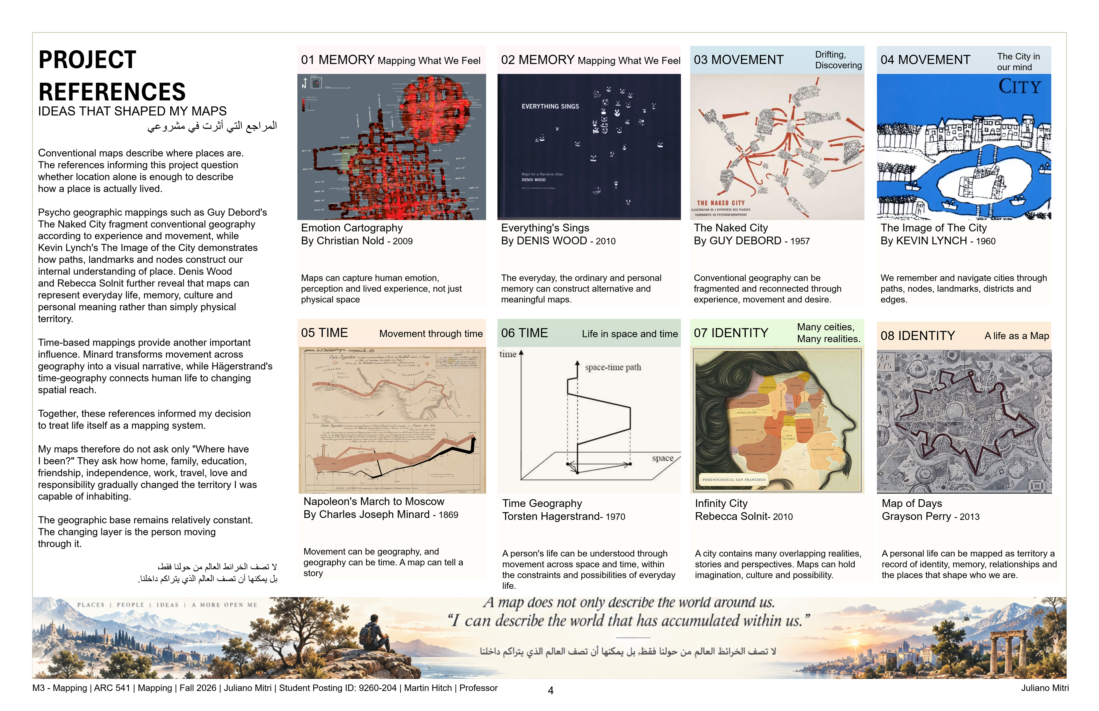
The project therefore treats mapping as a record of becoming rather than location. The physical world remains relatively constant while our relationship with it continuously changes.
After a lifetime of moving outward, the map eventually folds back toward home, family, and another life beginning from a much smaller geography.
The land was always there. I was the one who grew.
Perhaps growing up is not simply travelling farther from home but discovering how much of the world can become part of it.